
Griffith's Valuations Background:
Extract from Wikipedia, the free encyclopaedia website.
Griffith's Valuation was a boundary and land valuation survey of Ireland completed in 1868. Richard John Griffith started to value land in Scotland, where he spent two years in 1806-1807 valuing terrain through the examination of its soils. He used 'the Scotch system of valuation' and it was a modified version of this that he introduced into Ireland when he assumed the position of Commissioner of Valuation.
Tasks in Ireland
In 1825 Griffith was appointed by the British Government to carry out a boundary survey of Ireland. He was to mark the boundaries of every county, barony, civil parish and townland in preparation for the first Ordnance Survey. He completed the boundary work in 1844.
He was also called upon to assist in the preparation of a Parliamentary bill to provide for the general valuation of Ireland. This Act was passed in 1826, and he was appointed Commissioner of Valuation in 1827, but did not start work until 1830 when the new 6" maps, became available from the Ordnance Survey and which he was required to use as provided for by statute.
He served as Commissioner until 1868, when he was succeeded by Sir John Ball Greene CB, who took charge of the ongoing revisions of the valuation on an annual basis. Griffith also served as Chairman of the Board of Works. He conducted two major valuation surveys. First was the townland valuation, which was completed in the 1840s and which took the townland as the geographical unit of valuation. The second and more extensive, was the tenement survey which valued individual property separately for the first time and which also valued all buildings in the townland for the first time, whereas, previously only the larger houses, principally those of the gentry had been valued in the first valuation. The tenement valuations of County Dublin were the first to be published on 5 May 1853 and the last were the valuations of County Armagh on 1 June 1865
The Primary Valuation (also known as Griffith’s Valuation)
Extract from The National Archives Of Ireland website and the ''Ask About Ireland Website'' :
The Primary Valuation (also known as Griffith’s Valuation)
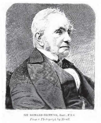
Sir Richard Griffith
Griffith’s Valuation is the name widely given to the Primary Valuation of Ireland, a property tax survey carried out in the mid-nineteenth century under the supervision of Sir Richard Griffith. The survey involved the detailed valuation of every taxable piece of agricultural or built property on the island of Ireland and was published county-by-county between the years 1847 and 1864.
The process of valuation was painstakingly thorough, involving multiple visits by valuation teams to analyse all of the factors influencing the economic status of the property: the chemical and geological properties of the land; average rents paid in the area; distance from the nearest market town. The aim was to get as accurate as possible an estimate of the annual income that each property should produce. This is the “Net Annual Value” figure (in £ s d, pounds sterling, shillings and pence) in the far right column of each valuation record. This was then used as the basis for local taxation, and continued up to the 1970s. The local authorities decided on a percentage of the Annual Value to be paid every year and usually expressed as “pennies to the pound”. For example a rate of 3 pennies to the pound meant that someone in possession of property valued as £10 would have to pay 30 pence, or 2/6.
The individual in economic occupation of the property was responsible for payment of the local taxation based on Griffith’s, with one exception: tenants with a holding valued at less than £5 annually were exempt, but their landlord was liable for the tax. This liability was a powerful incentive for landlords to get rid of smaller tenants in any way they could and certainly contributed to the wave of evictions that took place throughout the second half of the nineteenth century.
The Primary Valuation (also known as Griffith’s Valuation) was published between 1847 and 1864. There is a printed valuation book for each barony or poor law union in the country showing the names of occupiers of land and buildings, the names of persons from whom these were leased and the amount and value of the property held. These records are available to consult on microfiche in our Reading Room and can also be searched free of charge at www.askaboutireland.ie/griffith-valuation/index
The National Archives also holds the following preliminary records for the Primary Valuation: Field Books, House Books, Mill Books, Quarto Books and Tenure Books
The following finding aids to the Tithe Applotment Books and Primary Valuation are available to consult in the Reading Room:
- List of the Tithe Applotment Books arranged by Church of Ireland parish;
- List of the Primary Valuation books arranged by civil parish;
- Combined list of the Tithe Applotment Books and Primary Valuation arranged by county, barony and civil parish;
- Indexes of Surnames in the Tithe Applotment Books and Primary Valuation books (one or more volumes per county);
- List of books relating to the preliminary valuation arranged by type and then by county, barony and civil parish.

The Griffiths Valuation Revision Books
Griffiths Revision Valuation Records are important and revealing updates to the original 1853 GV Primary Valuation documents. Those span circa 1859-1977.
We will be adding those to the respective family G&T pages as we compile the relevant GV Revision information.
Genealogy
For excellent additional Genealogy Research Resources - Visit this excellent Genealogy page at the National Archives Genealogy Website. From this page, you can now access the Census Records for 1901 and 1911, Census survivals for 1821-51, Census Search forms for 1841-51, the Tithe Applotment Books from 1823 to 1837, the Soldiers’ Wills from 1914 to 1917, and the Calendars of Wills and Administrations from 1858 to 1922.
From 15 September 2016, you can access six major new record series on this site:
- Prerogative and diocesan copies of some wills and indexes to others, 1596 – 1858
- Diocesan and Prerogative Marriage Licence Bonds Indexes, 1623 – 1866
- Catholic qualification & convert rolls, 1700 – 1845
- Valuation Office house, field, tenure and quarto books 1824 – 1856
- Shipping agreements and crew lists, 1863 – 1921
- Will Registers 1858 – 1900
All of these records are free to access, through searchable databases and linked images of relevant pages. Eventually, we hope that the site will contain all of the important and easily accessible genealogical material in the custody of the National Archives.
- Census of Ireland, 1901 and 1911, and pre-1901 survivals
- Census Search Forms, 1841 – 51
- Tithe Applotment Books, 1823 – 37
- Soldiers’ Wills, 1914 – 1918
- Calendars of Wills and Administrations, 1858 – 1922
- Prerogative and diocesan copies of some wills and indexes to others, 1596 – 1858
- Diocesan and Prerogative Marriage Licence Bonds Indexes, 1623 – 1866
- Catholic qualification & convert rolls, 1700 – 1845
- Valuation Office house, field, tenure and quarto books 1824 – 1856
- Shipping agreements and crew lists, 1863 – 1921
- Will Registers 1858 – 1900